


U.S. Disaster Surveyor app for iPhone and iPad
Developer: Andrew Olvera
First release : 08 Jun 2018
App size: 33.61 Mb
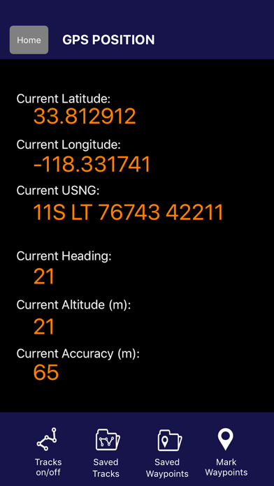
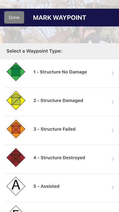
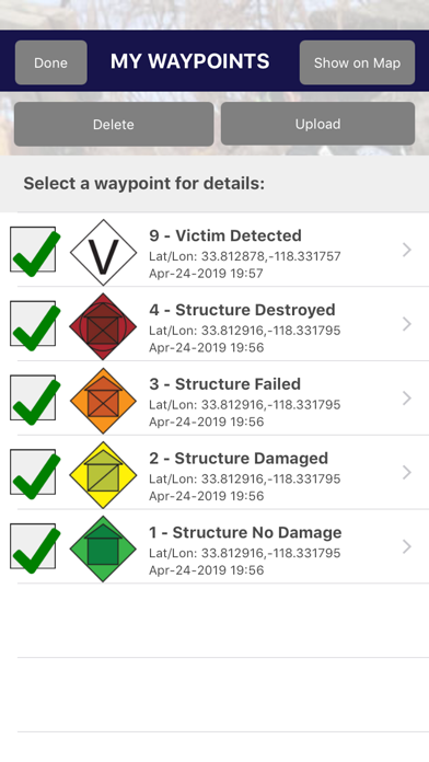
U.S. Disaster Surveyor is designed by and for domestic first responders for collecting information to coordinate urban search and rescue operations. Compliant with NAPSG USAR v7 Waypoint symbology for FEMA and SUSARs, as well as simple team messaging, maps and more. The app and accompanying website give any team or group the ability to gain situational awareness for disaster recovery and rescue efforts. All information uploaded to the website can be exported to Excel, KML, and GPX formats and posting to ones ArcGIS Online Operations Dashboard. Disaster Surveyor provides a complete solution to your emergency team coordination needs.
IMPORTANT NOTE: The Wifi only iPad does not have a dedicated Assisted GPS chip. The Wifi + Cellular version has the chip, but in the event of no Wifi signals and no Data signal areas (open ocean, high desert, steel/heavy concrete buildings), the GPS feature may not work. We recommend adding a dedicated GPS attachment for these purposes.
TEAM MANAGERS/LEADERS: Please contact [email protected] to have your Disaster Surveyor account upgraded as a Team Admin that can manage your team members with the same team code on the website.